
TX25-26 - NTP - Geography Review
Authored by Brian Medlin
Social Studies
7th Grade
Used 11+ times


AI Actions
Add similar questions
Adjust reading levels
Convert to real-world scenario
Translate activity
More...
Content View
Student View
10 questions
Show all answers
1.
DROPDOWN QUESTION
1 min • 1 pt
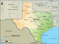
(a) is the study of the earth and the people who live on it.
2.
FILL IN THE BLANKS QUESTION
1 min • 1 pt

What is "a sphere with a map of the world printed on it"?
(a)
3.
CATEGORIZE QUESTION
3 mins • 1 pt

Put each of these items into the correct CATEGORY. When completed, there will be THREE [3] items in each category.
Groups:
(a) MAJOR CITIES
,
(b) BOUNDARY RIVERS
,
(c) BORDER STATES
Sabine
Louisiana
Austin
New Mexico
Dallas
Red
Rio Grande
Oklahoma
Houston
4.
MULTIPLE CHOICE QUESTION
30 sec • 1 pt
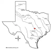
The Colorado River flows through our state capital of -
Dallas
Houston
San Antonio
Austin
5.
LABELING QUESTION
1 min • 1 pt
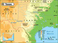
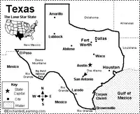
Label this map with the names of places around Texas.
6.
MULTIPLE CHOICE QUESTION
30 sec • 1 pt
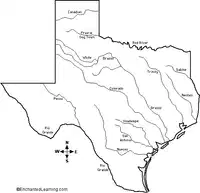
All of these are rivers that help form the boundary [shape] of Texas EXCEPT -
Rio Grande River
Colorado River
Red River
Sabine River
7.
MATCH QUESTION
1 min • 1 pt
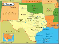
Match each of these TITLES with the correct list of items
Oklahoma
Louisiana
New Mexico
Arkansas
CAPITAL of TEXAS
Dallas
Houston
San Antonio
MAJOR CITIES
Austin
BORDER STATES
Rio Grande
Sabine
Red
BOUNDARY RIVERS
Access all questions and much more by creating a free account
Create resources
Host any resource
Get auto-graded reports

Continue with Google

Continue with Email

Continue with Microsoft
or continue with

%20(1).png)
Apple

Others
By signing up, you agree to our Terms of Service & Privacy Policy
Already have an account?



