

Places and Regions - South Asia

Presentation
•
Geography
•
7th Grade
•
Practice Problem
•
Medium

Mark Thompson
Used 668+ times
FREE Resource
6 Slides • 14 Questions
1
Places and Regions - South Asia
7.2.1 PR Identify select Asian physical systems and human characteristics of places.
2
India is a subcontinent
It is on its own tectonic plate that collided with the Eurasian plate around 50 million years ago.
This created the Himalayas, the highest mountains in the world!

3
Multiple Choice

What was an impact of the collision of the Indian subcontinent with Asia millions of years ago?
4
Multiple Choice

What mountain range is being highlighted on this map of South Asia?
5
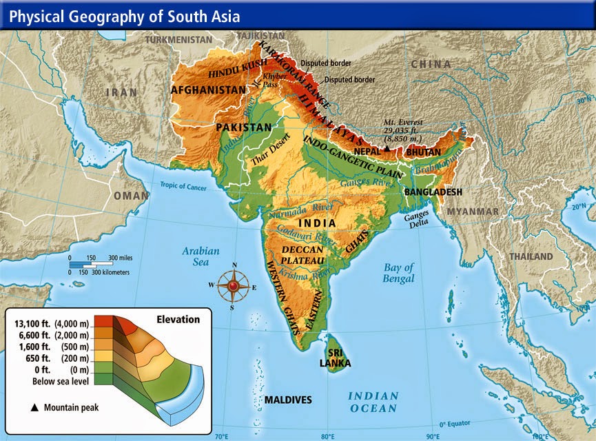
Physical Geography of South Asia
Mountains on both coasts (Eastern Ghats, Western Ghats)
Deccan Plateau between Ghats mountains in southern part
Himalayas, Karakoram and Hindu Kush mountains in northern part
Major rivers in north: Indus, Ganges, Brahmaputra
6

7
Multiple Choice

What are the mountains on the coast of India known as?
8
Multiple Choice

What is the area of high, flat land between the Eastern and Western Ghats called? (shown in gray on the map)
9
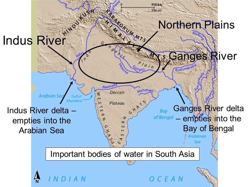
Study this for the next 3 questions.
10
Multiple Choice

Which river, sacred to Hindus, is being identified by the red arrow on the map?
11
Multiple Choice

Which river, site of an ancient civilization, is shown on the map?
12
Multiple Select

Which three bodies of water border South Asia?
13
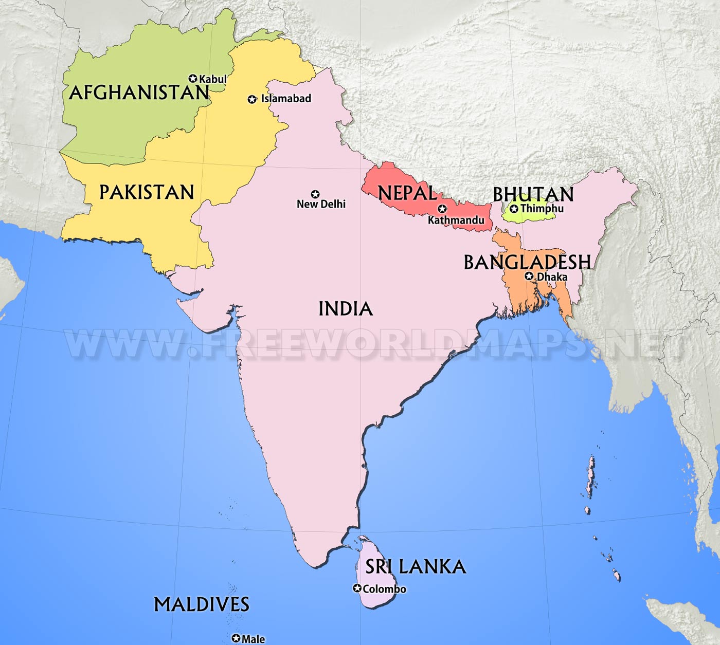
Countries in South Asia
India
Pakistan
Afghanistan (sometimes included in Central Asia)
Nepal
Bhutan
Bangladesh
Sri Lanka, Maldives (islands)

14
Multiple Choice

Which country is number 1 on the map?
15
Multiple Choice
Which country is number 2 on the map?
16
Multiple Choice
Which country is number 3 on the map?
17
Multiple Choice
Which country is number 4 on the map?
18
Multiple Choice
Which country is number 5 on the map?
19
Multiple Choice
Which country is number 6 on the map?
20
Multiple Choice
Which country is number 7 on the map?
Places and Regions - South Asia
7.2.1 PR Identify select Asian physical systems and human characteristics of places.
Show answer
Auto Play
Slide 1 / 20
SLIDE

