Unit 11 Test review
Presentation
•
Geography
•
6th - 8th Grade
•
Practice Problem
•
Medium
Katherine Davis
Used 12+ times
FREE Resource
1 Slide • 15 Questions
1

2
Labelling
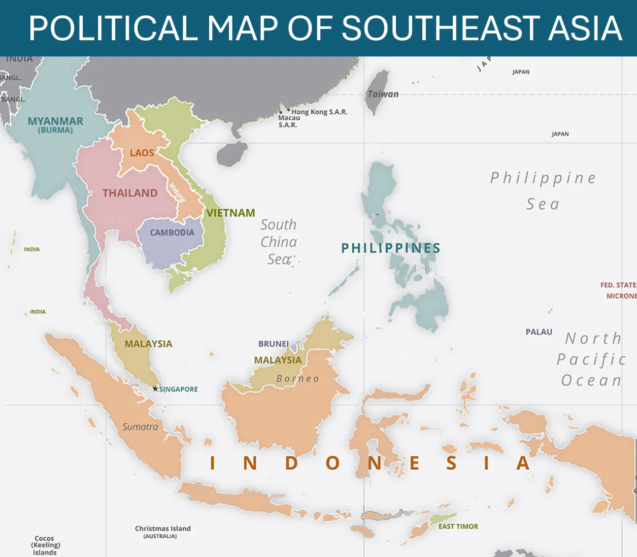
Match the rivers
Irrawaddy River
Chao Phraya River
Mekong River
3
Categorize
Philippines
Vietnam
Thailand
Indonesia
Use the map to help you place the countries below in the correct category: mainland or island.
4
Match
Match each vocabulary word with the correct definition.
living or existing in a land from its earliest times or from before the arrival of colonists
giant sheets of ice that float on the ocean but are attached to the land
formed by underwater volcanic eruptions
aboriginal
ice shelf
high island
aboriginal
ice shelf
high island
5
Multiple Choice
Which factor leads to different weather in Southeast Asia at different times of the year?
landslides
the Equator
monsoon winds
6
Multiple Choice
What is the main reason Singapore is a wealthy country?
It has abundant natural resources.
It is located along a major trade route.
It has a large population of workers.
7
Multiple Choice
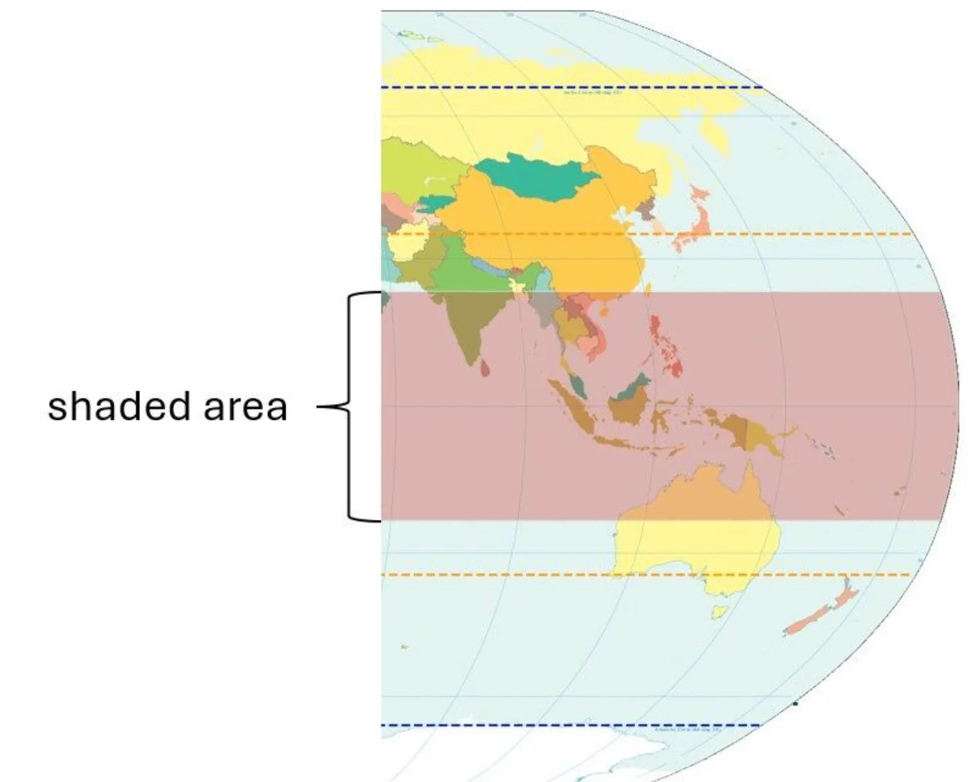
What area is shaded on the map below?
the poles
the tropics
8
Multiple Choice
Which religion did Europeans introduce to Southeast Asia?
Islam
Hinduism
Christianity
9
Multiple Choice
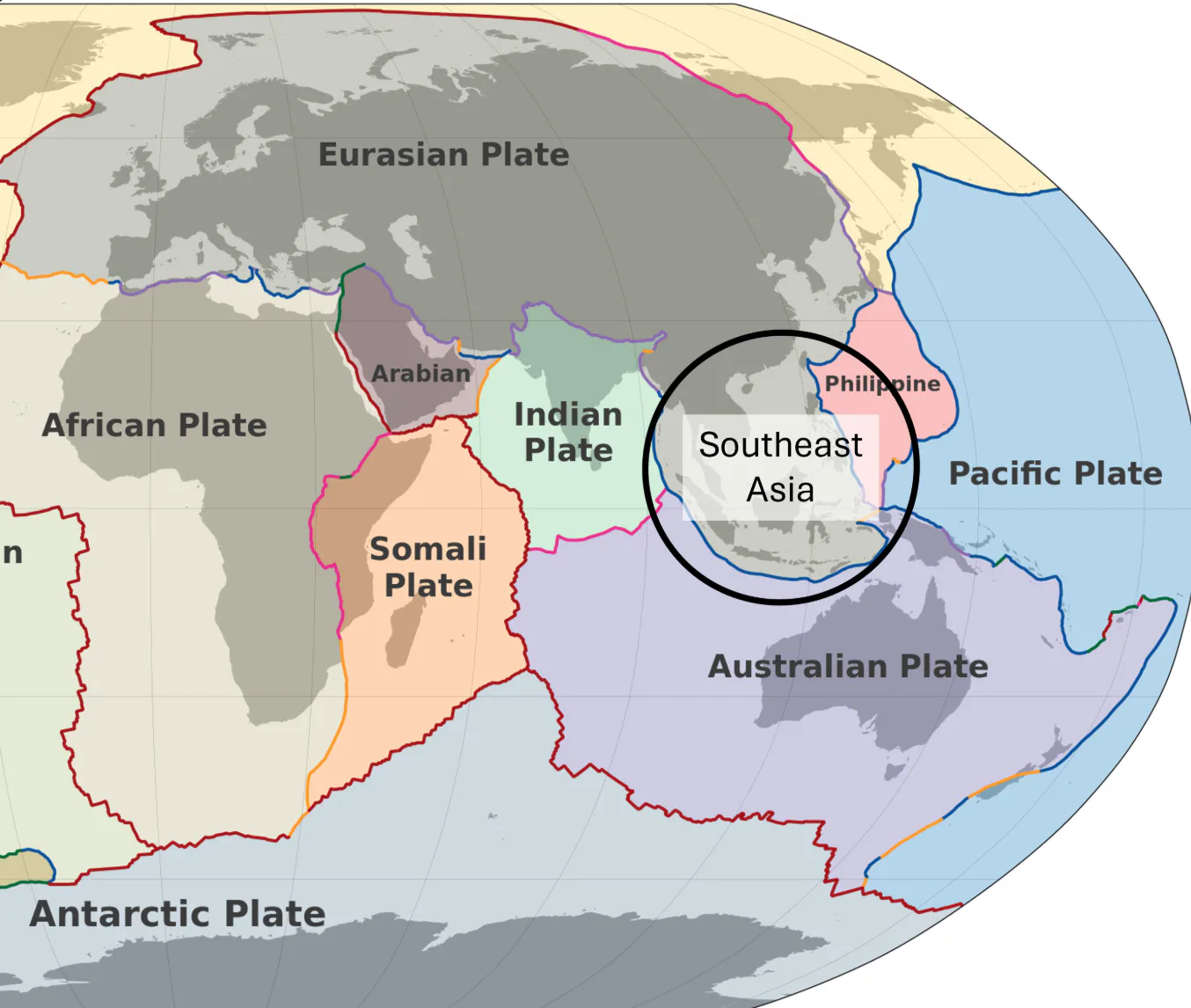
Which of the following statements can best be supported by the map of tectonic plates?
Southeast Asia's climate is hot and humid.
A lot of earthquakes affect Southeast Asia.
Most of Southeast Asia was colonized in the past.
10
Multiple Choice
What is a major purpose of the Association of Southeast Asian Nations (ASEAN)?
to build military strength among Southeast Asian countries
to help Southeast Asian countries gain independence
to support trade among Southeast Asian countries
11
Multiple Choice
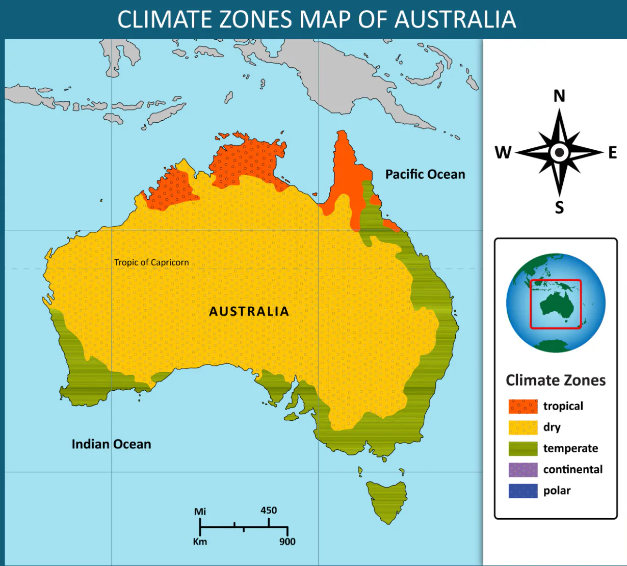
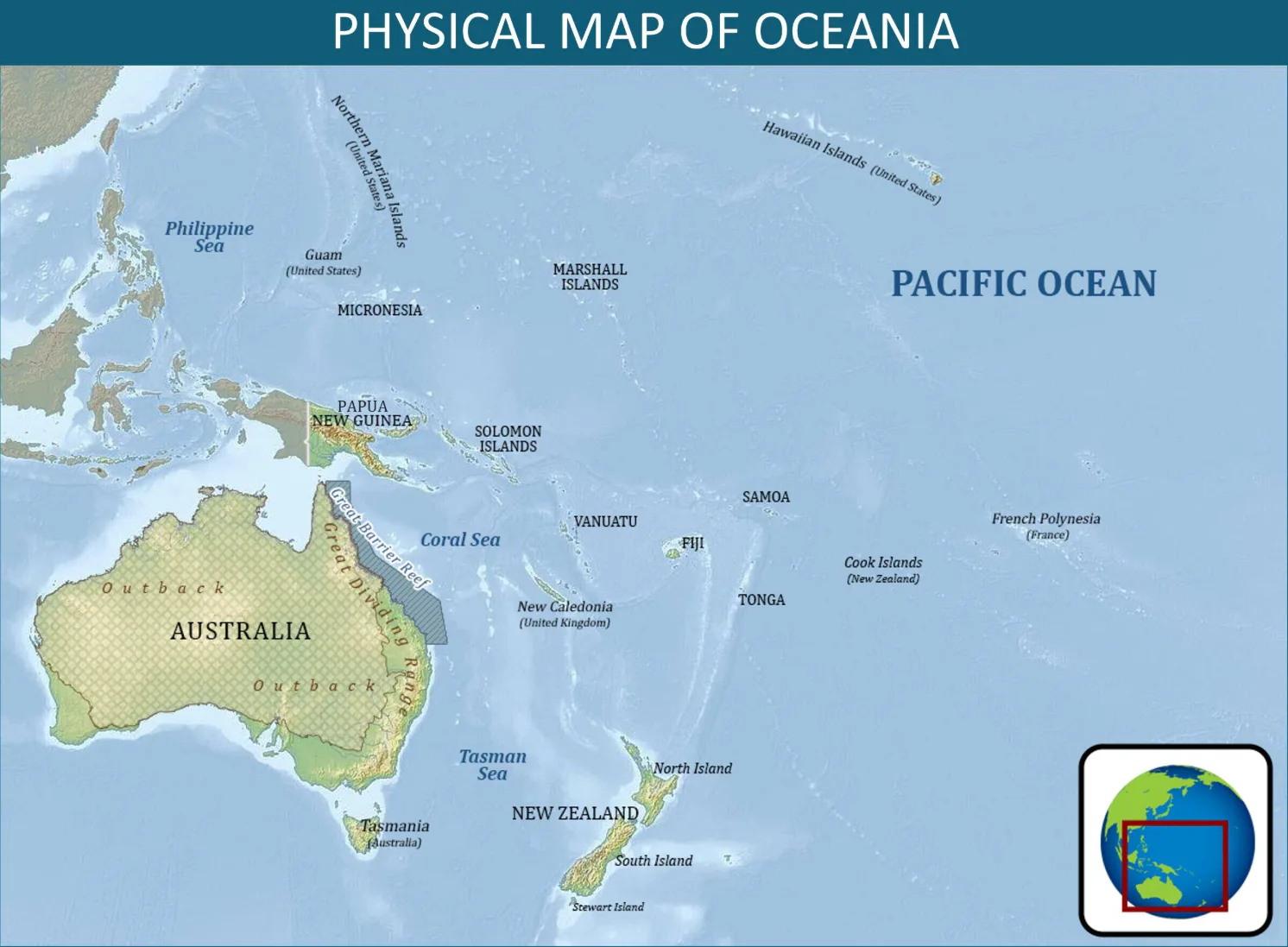
Which of the following statements can best be supported by the map?
Australia's temperature varies a lot between winter and summer.
Australia's interior does not have a good environment for growing crops.
Australia has abundant mineral resources.
12
Multiple Choice
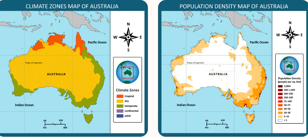
Examine the map of climate zones and the map that shows population density of Australia.
What conclusion could someone draw by examining the two maps?
Not many people live in the dry climate zone.
Most of Australia’s population live near rivers.
Most of Australia's economic activity takes place in the dry climate zone
13
Multiple Choice
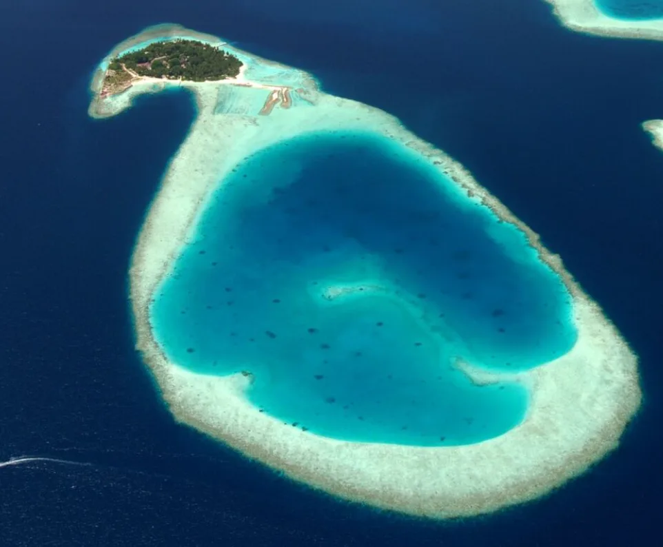
The image shows an atoll.
What features define this island as an atoll?
The island is shaped like a ring.
The island was formed from a volcanic crater.
The island is less than three feet above sea level.
14
Multiple Choice
Why is Antarctica classified as a desert?
because it is sandy under its layer of ice
because it gets little precipitation
because few people live there
15
Categorize
Samoa
Marshall Islands
New Caledonia
Guam
Some islands or archipelagos in Oceania are independent countries, and others are territories of other nations. Place the countries below in the correct category: independent country or territory of another nation.
16
Open Ended
Explain one aspect of culture that developed differently in parts of Southeast Asia
AND
Explain how geography affected the development of the culture
Show answer
Auto Play
Slide 1 / 16
SLIDE

Similar Resources on Wayground
11 questions
Independent and Subordinate Clauses
Presentation
•
6th - 8th Grade
10 questions
Artists
Presentation
•
6th - 8th Grade
10 questions
Homeostasis
Presentation
•
6th - 8th Grade
10 questions
Spanish Greetings, introductions, and farewells
Presentation
•
6th - 8th Grade
14 questions
Five Themes of Geography
Presentation
•
6th - 8th Grade
11 questions
Paired Text
Presentation
•
6th - 8th Grade
11 questions
Teenager 5 Session 24: Pronunciation & Speaking
Presentation
•
KG
11 questions
Writing an Introduction
Presentation
•
6th - 8th Grade
Popular Resources on Wayground
24 questions
PBIS-HGMS Day 10
Quiz
•
6th - 8th Grade
10 questions
HCS SCI 03 Summer School Review 3
Quiz
•
3rd Grade
11 questions
Home Scope
Quiz
•
7th - 8th Grade
15 questions
HCS SCI 05 Summer School Assessment 3 Review
Quiz
•
5th Grade
35 questions
Lufkin Road Middle School Student Handbook & Policies Assessment
Quiz
•
7th Grade
18 questions
Geo 11.3 Area of Circles and Sectors
Quiz
•
9th - 11th Grade