Middle East Geographic
Presentation
•
Social Studies
•
7th Grade
•
Practice Problem
•
Medium
Latasha Creamer
Used 2+ times
FREE Resource
43 Slides • 30 Questions
1
2
3
Multiple Choice
Which of the following correctly lists countries in the Middle East?
Qatar, Saudi Arabia, Jordan, Syria
Azerbaijan, Ethiopia, Yemen, India
Pakistan, Papua New Guinea, Spain, Portugal
Israel, Saudi Arabia, Lesotho, Turkey
4
5
Multiple Choice
What is significant about the location of the Tigris and Euphrates Rivers?
They provide a temperate climate for Iran
They provide water for crops, making the land fertile
They provide the large fishing industry a place to develop
It is the only source of water in the Arabian desert
6
7
8
9
Multiple Choice
What are the main features visible in the landscape of the image?
A river
Mountains
Desert
Urban area
10
11
Multiple Choice
What role did the Tigris River play in ancient Middle Eastern civilizations?
It was a source of gold
It was a central part of ancient civilizations
It was used for transportation only
It was a desert area
12
13
Multiple Choice
What are the different types of land use visible in the image?
Agriculture
Urban development
Forestry
Water bodies
14
15
Multiple Choice
What is the significance of the Jordan River for the regions it flows through?
It is a major source of water
It serves as a political boundary
It is the widest river in the world
It is the deepest river in the world
16
17
Multiple Choice
What is the significance of the Jordan River in the context of the surrounding countries?
It serves as a natural border
It is the longest river in the region
It is a major source of drinking water
It is a popular tourist destination
18
Multiple Choice
Which sea is crucial for trade between Europe, Asia, and Africa?
Baltic Sea
Mediterranean Sea
Black Sea
North Sea
19
20
Multiple Choice
What geographical features are visible in the image?
Mountains
River
Desert
Forest
21
22
Multiple Choice
What are the main features of the landscape shown in the image?
A river
Hills
Forests
All of the above
23
24
Multiple Choice
What is the significance of the Suez Canal in global trade?
It connects the Atlantic and Pacific Oceans
It allows ships to avoid the long route around Africa
It is the longest canal in the world
It is a natural waterway
25
26
Multiple Choice
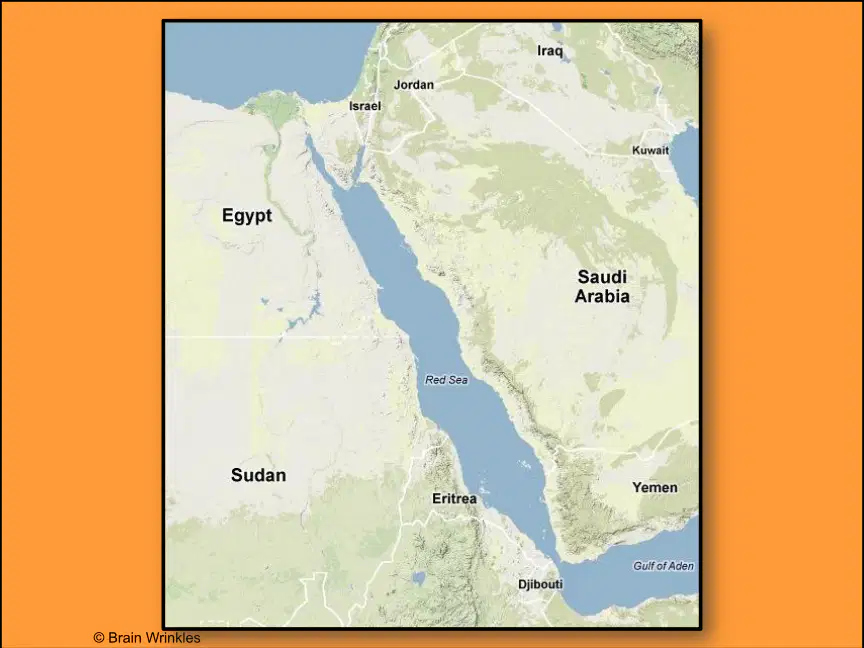
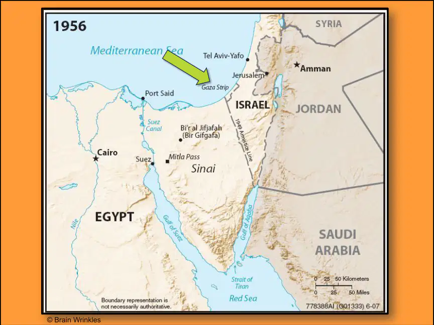
What is the significance of the Suez Canal in the context of the map provided?
It connects the Mediterranean Sea to the Red Sea
It is a major trade route
It is located in Egypt
It was built in 1956
27
Multiple Choice
The construction of the Suez Canal was completed in:
1869
1905
1798
28
Multiple Choice
How long is the Suez Canal approximately?
120 miles
150 miles
200 miles
29
Multiple Choice
What is the primary purpose of the Suez Canal?
To generate hydroelectric power
To serve as a natural border between countries
To connect the Mediterranean Sea with the Red Sea
30
31
Multiple Choice
What geographical features can be observed in the aerial view of the area?
Rivers
Mountains
Forests
Deserts
32
33
34
Multiple Choice
What is the significance of the Persian Gulf in terms of oil production?
It is a major shipping route for oil.
It has no oil fields.
It is only used for fishing.
It is a freshwater source.
35
Multiple Choice
36
37
Multiple Choice
What are the countries bordering the Persian Gulf?
Saudi Arabia
Iraq
Iran
Kuwait
38
Multiple Choice
Bahrain
Manama
Baghdad
Amman
Damascus
39
Multiple Choice
True or False: The Persian gulf is surrounded by Iran, Iraq, And the Arabian peninsula
True
False
40
Multiple Choice
The Persian Gulf lies between Saudi Arabia and what country?
Iran
Iraq
Oman
Yemen
41
42
Multiple Choice
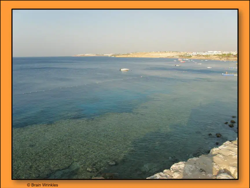
What body of water is depicted in the image?
Persian Gulf
Red Sea
Mediterranean Sea
Arabian Sea
43
44
Multiple Choice
Which process involves the wearing away of the coastline by the sea?
Deposition
Erosion
Transportation
Sedimentation
45
46
Multiple Choice
What is the primary purpose of the structures shown in the images?
Fishing
Oil extraction
Tourism
Research
47
48
Multiple Choice
What is the significance of the Strait of Hormuz in global shipping?
It connects the Atlantic Ocean to the Pacific Ocean.
It is a major route for oil supply.
It is the longest river in the world.
It is a popular tourist destination.
49
50
Multiple Choice
What is the significance of the Strait of Hormuz in global trade?
It connects the Mediterranean Sea to the Atlantic Ocean
It is a major oil shipping route
It is a tourist destination
It is a military base
51
52
Multiple Choice
What geographical features can be observed in the image?
Mountains
Rivers
Lakes
Deserts
53
54
55
Multiple Choice
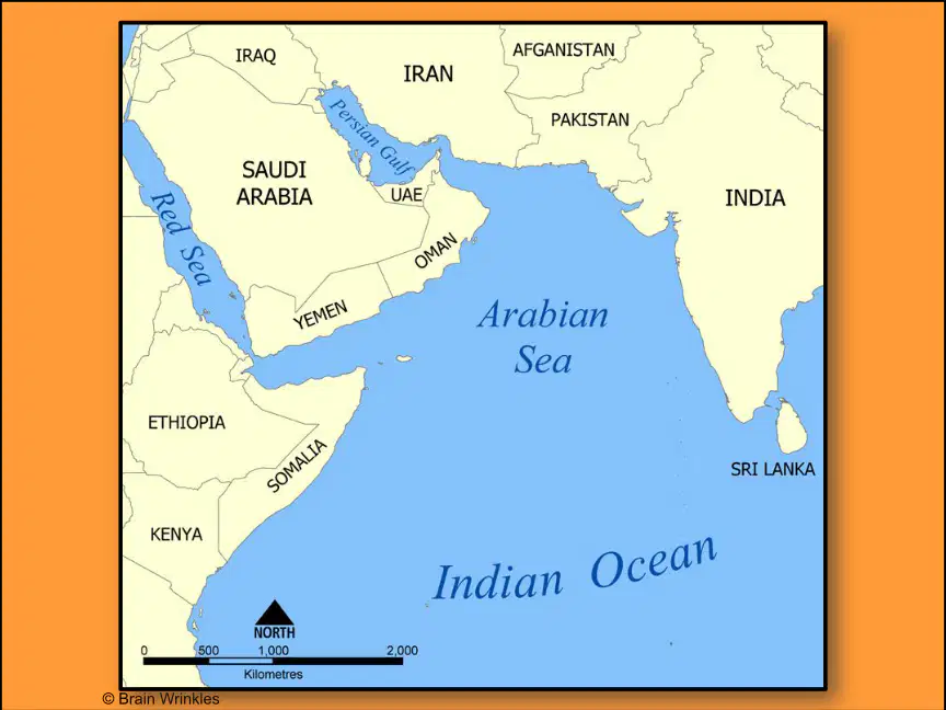
What are the countries bordering the Arabian Sea?
India
Pakistan
Iran
All of the above
56
57
58
59
60
61
62
63
64
65
66
67
68
69
70
71
72
73
Poll
How confident do you feel about this topic now?
Show answer
Auto Play
Slide 1 / 73
SLIDE

Similar Resources on Wayground
66 questions
Author's Purpose
Presentation
•
7th - 8th Grade
70 questions
Module 3, Lesson 2 New England Colonies
Presentation
•
8th Grade
65 questions
L06 GDP
Presentation
•
KG
67 questions
7th Grade Math Final Diagnostic Review
Presentation
•
7th Grade
66 questions
G7 - Chapter 11 Final Revision
Presentation
•
7th Grade
67 questions
Jim Crow Laws & Disenfranchisement
Presentation
•
6th - 8th Grade
70 questions
GRADE 7 ENGLISH END OF TERM 1 REVISION
Presentation
•
7th Grade
67 questions
Unit 2 Matter Unit Test
Presentation
•
7th Grade
Popular Resources on Wayground
24 questions
PBIS-HGMS Day 10
Quiz
•
6th - 8th Grade
10 questions
HCS SCI 03 Summer School Review 3
Quiz
•
3rd Grade
11 questions
Home Scope
Quiz
•
7th - 8th Grade
15 questions
HCS SCI 05 Summer School Assessment 3 Review
Quiz
•
5th Grade
35 questions
Lufkin Road Middle School Student Handbook & Policies Assessment
Quiz
•
7th Grade
18 questions
Geo 11.3 Area of Circles and Sectors
Quiz
•
9th - 11th Grade